Navigation Exercises – Golden Gate to Pillar Point
This navigation exercise requires
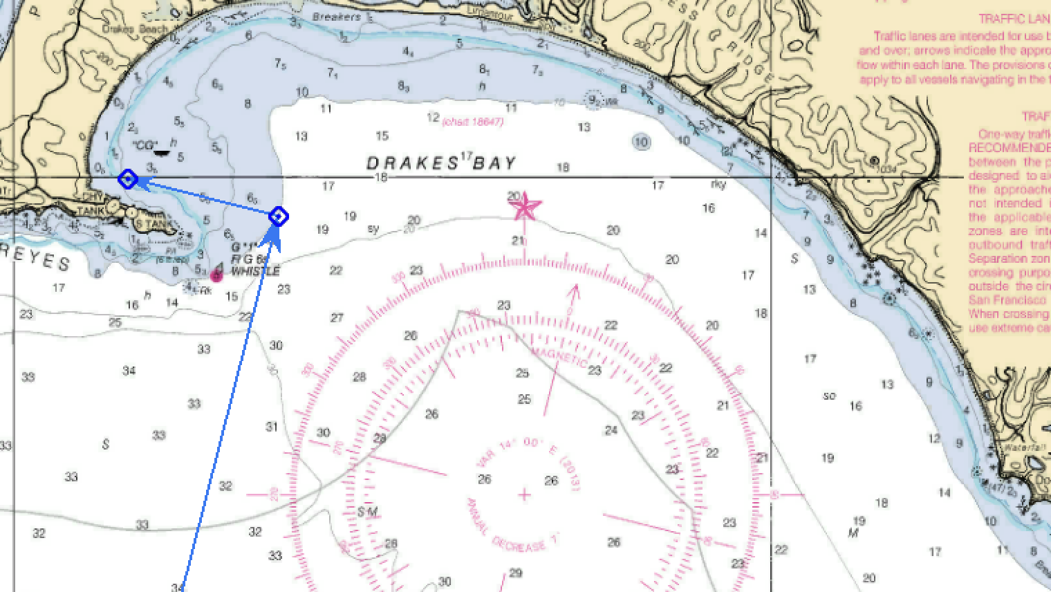
- Chart no. 18645 – Gulf of the Farallones
- Parallel rule
- Calculator
- Pencil
Exercise 1
It is June 4, 2020 and you are headed to Pillar Point for the weekend. Slack before flood is at 0724, so you time your arrival at the bridge for 0730. You arrive at R”8” (37° 46.55′ N, 122° 35.18′ W) in the Main Ship Channel at 0830 and turn to 180 (166M). There is fog along the coastline and you can’t see any landmarks or nav aids. Your vessel speed is 6 knots. First, Plot your DR ahead for the next 2 hours (1030).
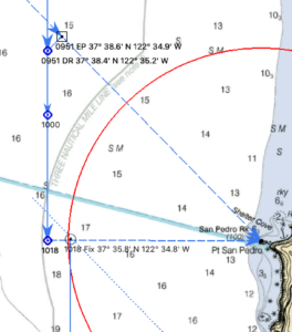
- The fog has cleared enough at 0951 to take a bearing of Pt San Pedro Rock. It is 122M and is 045 degrees relative off the port bow. What is your DR Lat and Lon?
- Use the bearing to determine your estimated position. What is the EP Lat and Lon?
Exercise 2
Continuing on your trip, at 1018 Pt San Pedro Rock bears 090 relative. Hint: Forget the EP. Continue with the DR plot.
- What is your distance off?
- Using distance off LOP and the bearing LOP to Pt San Pedro Rock to get a fix. What is your Lat and Lon?
- Advance the 0951 bearing to Pt San Pedro Rock forward to 1018. What does this do to your fix?
Exercise 3
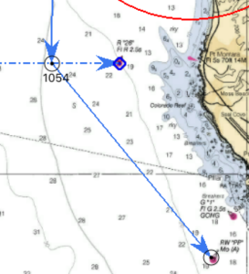
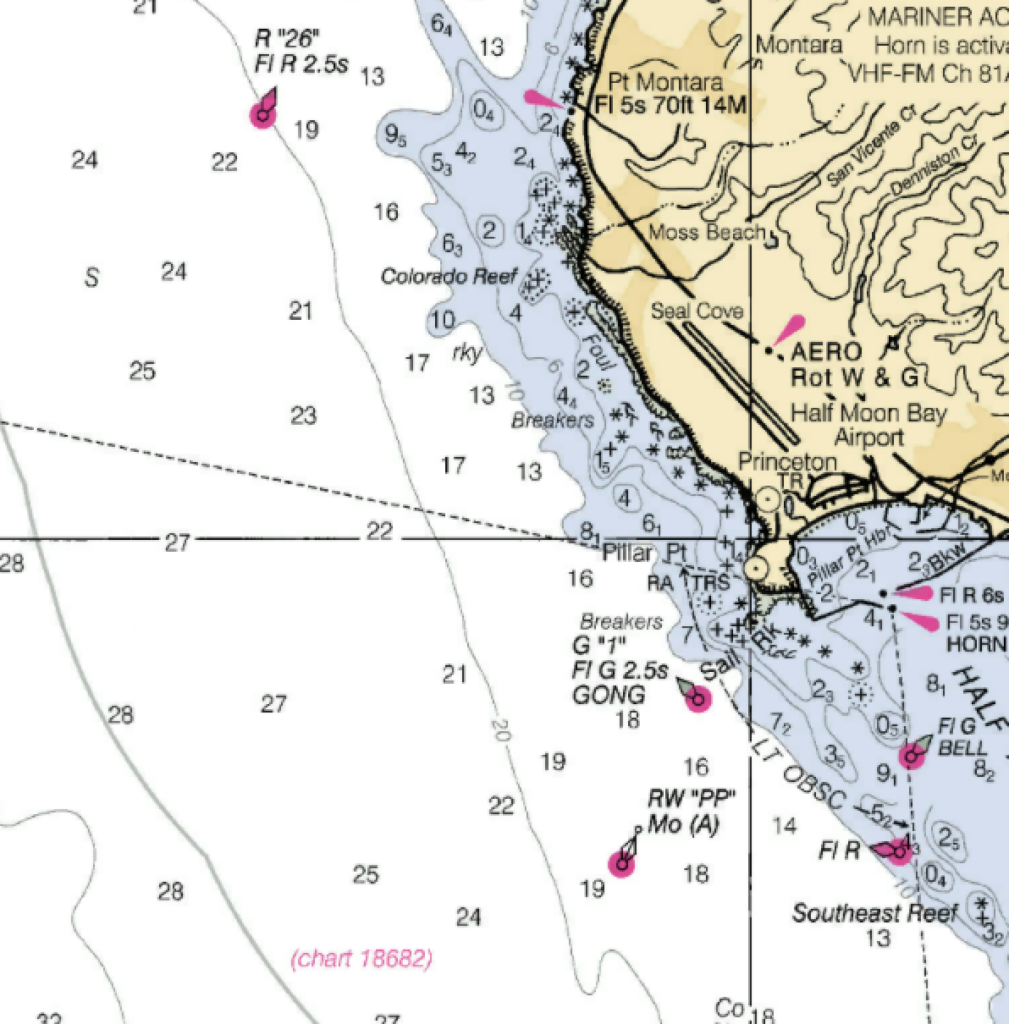
Continuing on your course of 180T, you plan to turn towards the Pillar Point approach buoy (RW “PP” (37° 28.35′ N 122° 30.83′ W) when abeam of R “26” (37° 32.17’ N, 122° 33.09 W).
- What is the ETA to the turn?
- How far away from R “26” are you set to pass?
- What is the bearing (M) to the Pillar Point radar tower when you make your turn abeam R”26″?
- What course will you turn to head for RW “PP” (37° 28.35′ N 122° 30.83′ W)?
- What is your ETA at RW “PP”?
Exercise 4
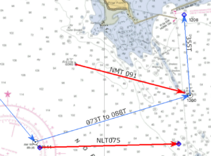
Continue on a course to take you into Pillar Point Harbor.
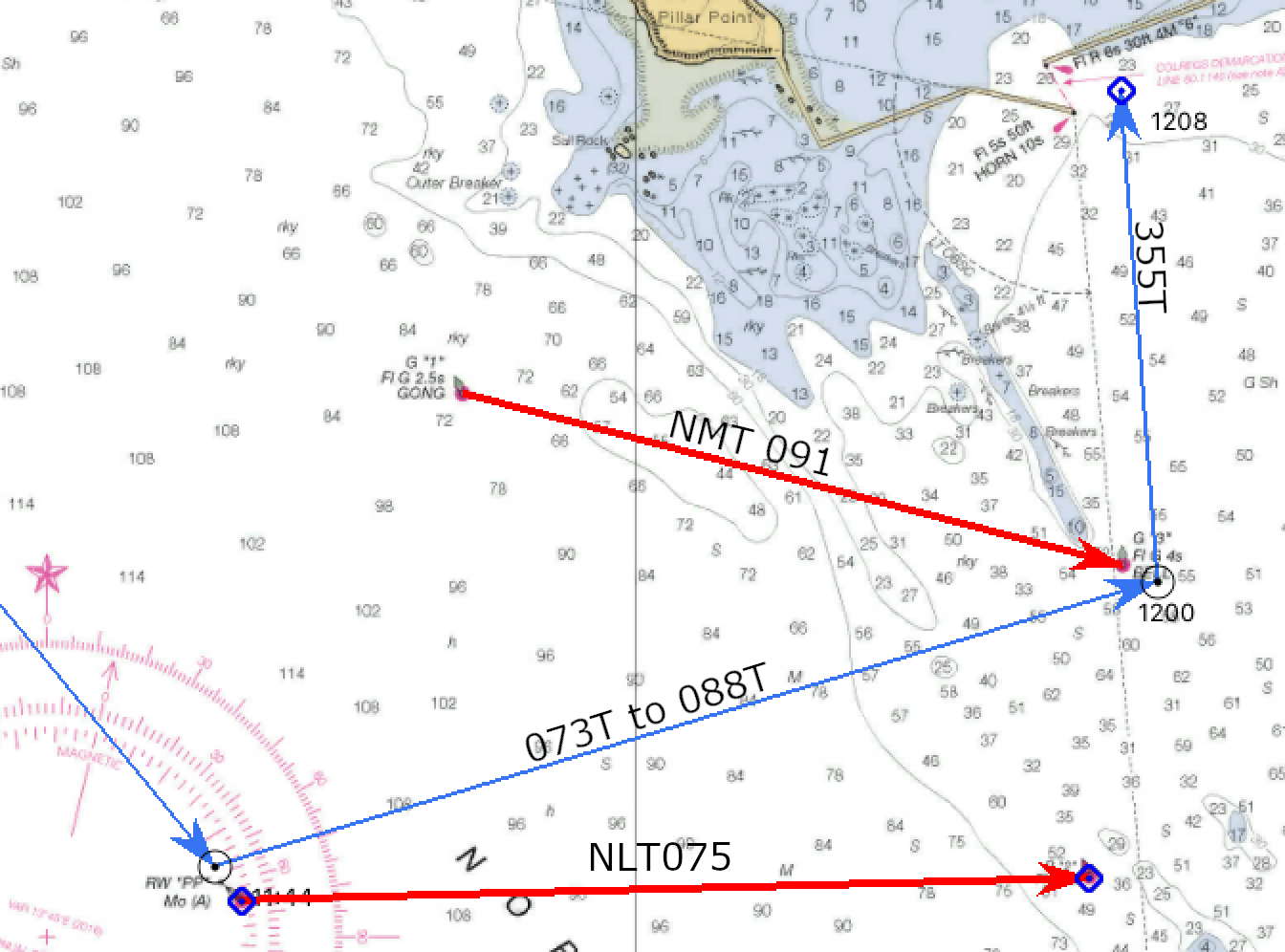
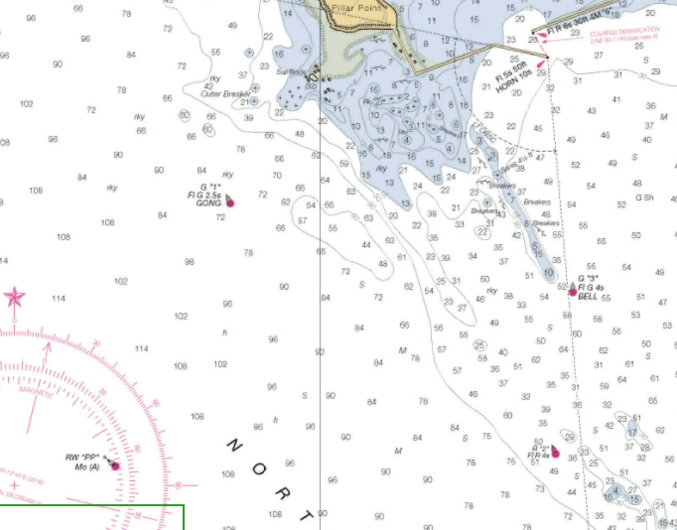
- Set up two danger bearings to guide you between the two reefs. Danger bearing 1 i a line from G”1″ to G”3″. Danger bearing 2 is a line from PP to R”2″. In degrees magnetic, what are the two danger bearings? Remember to label NMT or NLT.
- What course would you follow from your turn near PP to travel through the channel?
- Once clear of the channel, what course would take you to the entrance of Pillar Point Harbor?

You May Also Like