Impact of the Land on the Wind
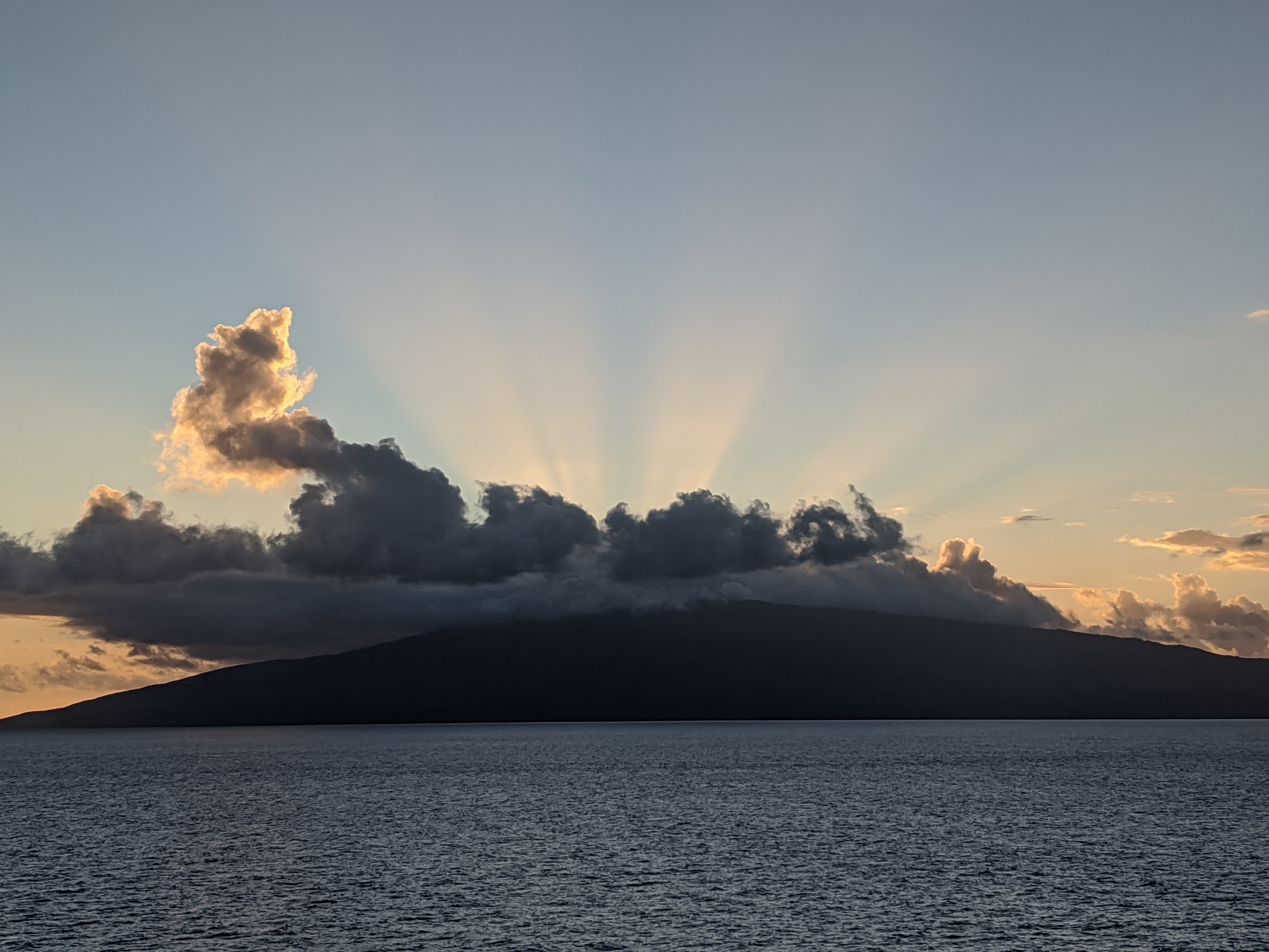
Sea Breeze
Land warms and cools much quicker than nearby bodies of water. During the daytime, radiation from the sun creates warming of the land and the air above it. The resulting warmer air weighs less and begins to rise. A pressure gradient is formed between it and the cooler, denser air over the water, resulting in airflow from water to land. This effect is known as a sea breeze.
Typically a sea breeze will start up mid to late morning, build throughout the day, and die out late afternoon to early evening. With a classic sea breeze, as the wind increases in speed, it will veer. This means that a morning sea breeze from the west might veer to the northwest as the movement of air intensifies throughout the afternoon. As will be seen below, shape of the land can and does influence wind direction and veer.
Typically, a sea breeze is only felt a short distance offshore.
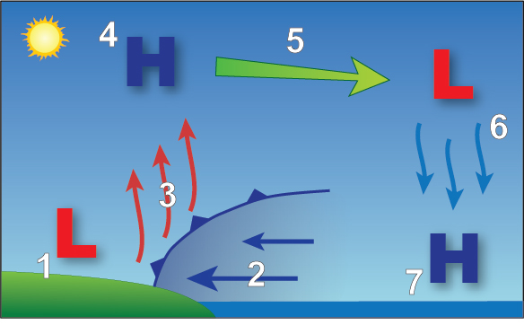
- Warming land creates a warming of the air above it resulting in lower pressure.
- The resulting pressure gradient moves the colder, denser air onshore.
- A boundary between the colder air and the warmer air creates a small cold front which forces its way under the warmer air, causing it to rise
- The rising air cools, resulting in a higher pressure area, generally 3,000 to 5,000 feet high.
- The higher pressure air moves to fill in a lower pressure area over the ocean.
- Sinking air results in a lower pressure area at 3,000 to 5,000 feet
- The air higher pressure area resulting from the sinking air begins to move toward shore, completing and continuing the cycle.
Sea Breeze Channeling
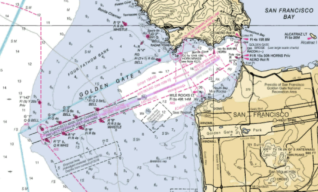
A great example of a consistent, reliable sea breeze is found along the central coast of California around San Francisco. Throughout the summer, California’s interior valleys soak up the rays of the sun, often heating to 100 degree plus temperatures. The resulting low pressure allows to cooler heavier ocean air to move onshore beginning late in the morning.
As the breeze moves onshore, it runs into the Coastal Range of mountains, effectively blocking its movement. As with any fluid, the moving air seeks out the paths of least resistance. The most notable gap in the area is the Golden Gate, a 2 plus mile long, cliff lined channel through the land mass which narrows to less than 1 mile wide. The Golden Gate runs more or less southwest to northeast.
Consequently, the sea breeze from a large area of coastline is concentrated into a small area. The mild 5 or 10 knot sea breeze felt in the ocean off San Francisco is increased as it travels through the Golden Gate. By the time it reaches the bay, wind speeds are typically 25 or 30 knots, coming from the Southwest. From May to September, this process begins about 11:00 in the morning and generally dies out about 6:00 in the evening.
A similar effect on a larger scale is seen in the Strait of Juan de Fuca between Washington and Canada.
Land Breeze
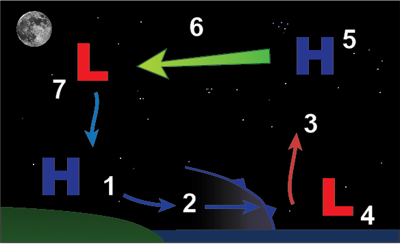
A land breeze is essentially the reverse of a sea breeze. Land breezes only occur when the night time temperature of the land falls below the night time temperature of the sea’s surface. Land breezes are generally weaker than sea breezes.
Wind speed and direction changes
In the northern hemisphere, wind veers as it speeds up and backs as it slows down.
Back over land – veer over water
When wind passes from water onto land, it slows down. As stated above, wind backs as it slows down. Therefore, you can expect wind to back as it passes from water onto land.
Conversely, wind passing from land onto water speeds up and therefore veers.
Convergence and Divergence
It is critical to note before we start this topic that this is a very limited aspect of convergence and divergence. We will only be looking at convergence and divergence on the surface, not the rising and sinking of air that also comes with it. This topic is covered in much greater detail and scope in the lessons on storms.
Convergence at the surface is wind from different directions coming together. More air in the same space results in faster airflow.
Divergence at the surface is wind separating and following different directions. Less air in a given area means slower wind speed.
It is critical to note before we start this topic that this is a very limited aspect of convergence and divergence. We will only be looking at convergence and divergence on the surface, not the rising and sinking of air that also comes with it. This topic is covered in much greater detail and scope in the lessons on storms.

Convergence at the surface is wind from different directions coming together. More air in the same space results in faster airflow.
Divergence at the surface is wind separating and following different directions. Less air in a given area means slower wind speed.
Corner Effect
A corner effect is a small-scale convergence that can be quite severe. It occurs around steep islands and headlands.
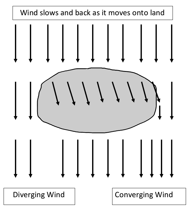
Wind flowing over a low, flat island will slow and back. At the wind exits the island, it will tend to veer and speed up, however, with an area of divergence on the downwind right side of the island as it relates to the direction of wind flow, and an area of convergence on the downwind left side.
Wind Shadows
Any obstruction in the path of the wind creates a shadow where the wind is blocked or lessened for a distance on the leeward side of the object. What air flow that is present may be turbulent.