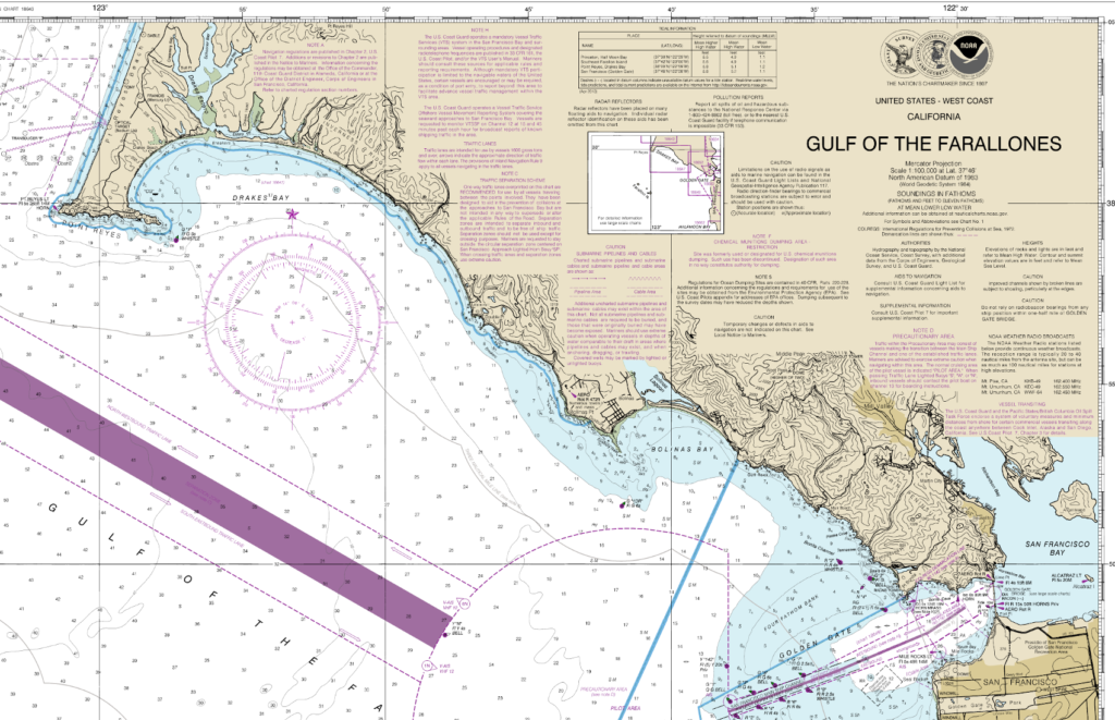
Latitude and Longitude
The method of determining location used by a mariner is latitude and longitude.
Parallels – Lines of Latitude
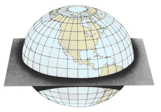
Lines of latitude run East/West marking off the degrees of an arc between the equator and each of the geographic poles.
The equator is 0°.
The North Pole is 90°N and the South Pole is 90°S.
Lines of latitude are also known as “parallels” owing to the fact that they run parallel to each other moving up and down the globe.
Meridians – Lines of Longitude
Lines of longitude, also known as “meridians”, run North/South, beginning at one pole, and terminating at the other.
As with any sphere, there are 360° around the Earth. In the case of meridians, the 360° degrees are divided into two segments of 180° moving east or west from the Prime Meridian which runs from pole to pole through Greenwich England.
Degrees North, South, East, & West
Latitude is expressed in degrees from 0 to 90 N or S.
Longitude in degrees 0 to 180 E or W.
Distance in Degrees
One degree of latitude equals a distance of 60 nautical miles and since latitude lines are parallel to each other, remains the same no matter the location on the Earth.
Longitude on the other hand has a distance between degrees at the equator of approximately 60 nautical miles, but converges as they move toward the poles, eventually meeting at the North and South Poles.
Each degree can be divided into 60 minutes. A minute of latitude equals one nautical mile. A minute can be further divided into 60 seconds with a second of latitude representing approximately 101 feet.
Accurately knowing your latitude and longitude to the second places your location on the Earth within about 100 feet.
Modern Convention
Modern convention is shifting away from using seconds, instead, using minutes and thousandths of minutes, called decimal minutes, with 1/1000th of a minute being equal to about 6 feet, or decimal degrees shown to the 4th or 5th decimal place.
An important point to keep in mind is that while theory or GPS may be able to provide accuracy of 6 feet, practical use of a chart limits accuracy to about .1 minute (about 600 feet).
Notation
I’m sure by now you have noticed how cumbersome it is to use the words degrees, minutes, and seconds. These words are rarely, if ever, written out by the navigator. Instead, these symbols are used:
° for degrees
‘ for minutes
“ for seconds
3 Ways to Say the Same Location
- 37 degrees 45 minutes 00 seconds North by 122 degrees 41 minutes 34 seconds West.
- 37°45’00” N, 122°41’34” W.
- 37°45.000’ N, 122°41.567’ W.
Deciding which format to use is a matter of personal preference.
Converting Minutes and Seconds to Thousandths of a Degree
The disadvantage of using decimal minutes is that many charts are set up in minute-second format. To convert seconds to decimal minutes, simply divide the number of seconds by 60. Multiplying thousandths by 60 will provide seconds.
Finding Latitude and Longitude
Finding the latitude and longitude of a position on a chart is a simple matter of drawing a horizontal line from the location to the latitude scale, and a vertical line from the position to the longitude scale, then reading the location from the scale.
As shown here, buoy RW “PP” Mo (A), the safe water approach buoy outside Pillar Point Harbor near Half Moon Bay, California is 37°28.3’N, 122°30.8’W.
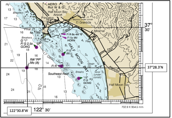
Horizontal and vertical lines are draw using the printed latitude and longitude lines provided on every chart. In the example shown, parallel rule could be lined up along latitude 37°30’ then moved down to line up with the buoy and a line draw to the scale. Similarly, the rule would be lined up with longitude 122°30’ and move over to the buoy, another line drawn, and the location read from the two scales.