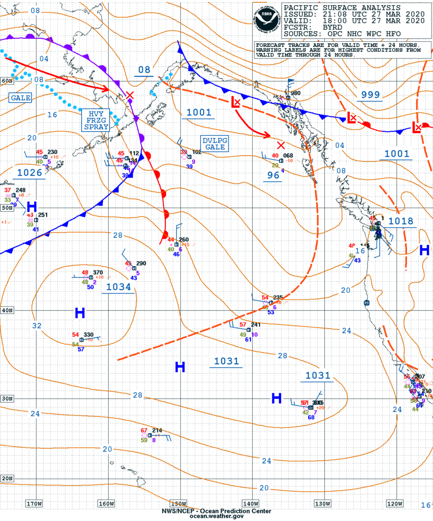
Introduction to the Surface Analysis
A surface analysis is a special type of weather map. The map provides a view of weather elements across a geographical area time based on information from ground-based weather stations and ship reports.
Surface analysis maps are created by plotting or tracing the values of relevant quantities such as sea level pressure and temperature onto a geographical map to assist the location of features such as weather fronts.