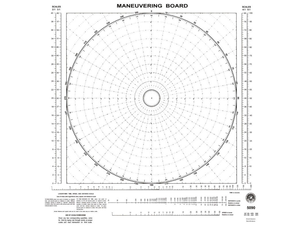
Maneuvering Board Layout
The maneuvering board (aka mo board) is a diagram used in the solution of relative motion problems. In marine navigation there are several “problems” involving the use of relative vectors. As it pertains to marine navigation, relative vectors contain two factors, speed and direction.
Common problems encountered in navigation that are greatly simplified by the use of a mo board include:
- Relative wind to true wind calculations
- True wind to relative wind calculations
- Course to steer to avoid a storm
- Set and Drift
- Course to steer to overcome set and drift
- Relative motion of another vessel/object and its closest point of approach
- True course of another vessel
- Course to steer to avoid collision with another vessel/object
While all relative vector problems are plotted basically the same way, each problem has its own specific requirements such as labels. Therefore, each of these are discussed in full in individual lessons dedicated to the topics.
Parts of the Maneuvering Board
There are three main “parts” to the mo board.
Distance and Bearing Compass Rose
Most prominently displayed is a top down (polar) view consisting of equally spaced radial lines at 10∘ intervals. An outer ring of numbers represents the points of a compass increasing in value in a clockwise direction from 0 at the top to 360. 1∘ increments are found between each 10∘ radial. An inner ring of numbers provides the reciprocal (180∘ difference) value for each primary radial.
There are ten equal distant concentric circles, with each concentric circle subdivided by ten equally spaced dots. These concentric circles typically represent miles and tenths of a mile.
Scale
In the left-hand margin there are two vertical scales (2:1 and 3:1) and in the right-hand margin there are two vertical scales (4:1 and 5:1) to be used for easy conversion of distances up to 50 miles to the 10 ring distance scale in the rose.
Nomogram
A logarithmic time-speed-distance (TSD) scale and instructions for its use are printed at the bottom.
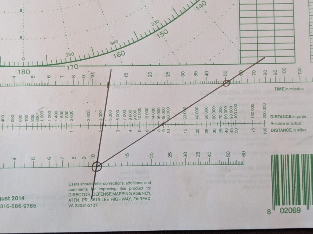
Using The TSD Nomogram
Three logarithmic scales are provided. Time in Minutes (0 to 200 minutes), Distance in Yards and/or Nautical Miles (25 to 200,000 yards) , and Speed in Knots (1 to 60 knots). Any two known quantities will provide a solution for the third with a simple line.
In the example below, another vessel has traveled 2.2 miles over a twelve minute time span. A line from 12 minutes on the top scale, drawn through the 2.2 mile value on the middle scale provides a speed of 11 knots.
That same vessel, will travel 8.8 miles over a 50 minute time period.
This example quickly calculated the relative speed of approach of another vessel, and the time required (50 min) to its closest point of approach.