Create a Universal Plotting Sheet
There may be times when a navigation chart showing contours along the coast and/or navigational hazards is not needed. This is generally the case with celestial navigation, however, you may also find times while piloting along a coast that this is the case. An example might be that you prefer to keep your DR and Fix plotting off of the navigation chart in order to keep it more readable. Using a Universal Plotting Sheet allows you this flexibility.
Universal Plotting Sheets may be purchased in pads of 50, or they may be downloaded from the internet. Generally, they will include a compass rose in the center, three pre-drawn latitude lines, and one centrally located line of longitude. They are printed with “minute” marks (miles) for latitude and a scale to use in determining minutes of longitude. Having a pad on board is always a good idea.
Unfortunately, having a pad on board is not always the case, and “using the up” during practice can be expensive and frustrating. Fortunately, there is another solution. You can use any conveniently sized paper (e.g. 8.5 x 11) to make your own. I personally like to just use a blank notebook as a navigation log, and use a blank page in it to create universal charts as needed. Here is how.
Plot The Primary Latitude and Longitude Lines
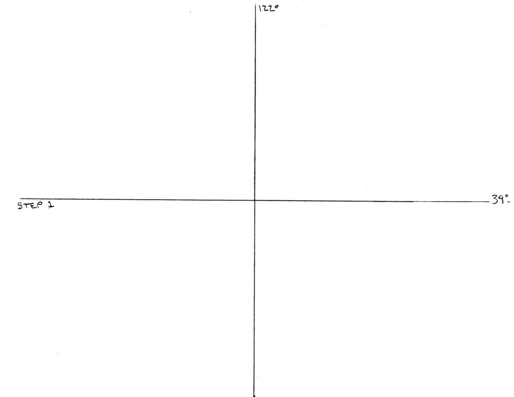
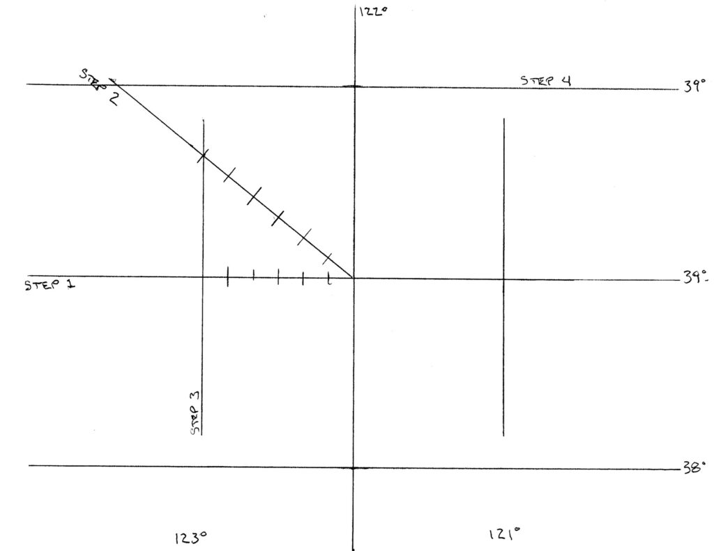
Step one: Using a convenient size of paper (in this case, 8.5 x 11), draw a horizontal line and a vertical line at approximately the center of the page. Label the horizontal line with the desired latitude and the vertical line with the desired longitude. In the example, Latitude 39N and Longitude 122 W were selected.
Draw an Angle Representing Your Latitude
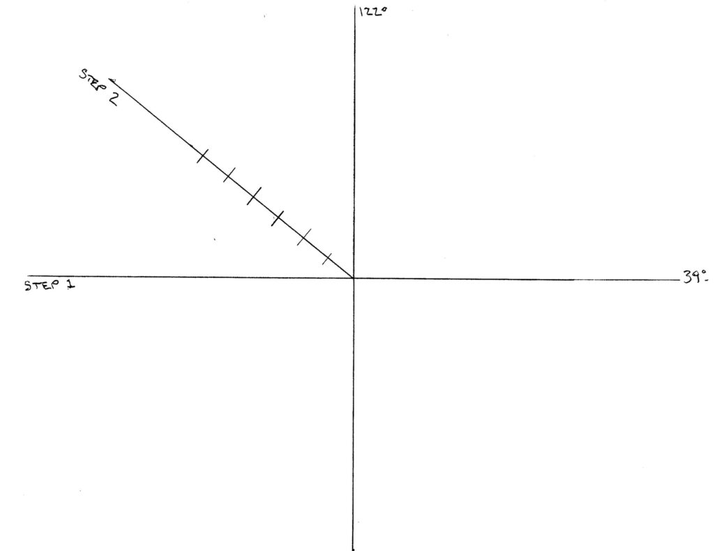
Step two: Draw an oblique (diagonal) line representing the angle equal to the center longitude line. Here, the line is drawn at a 39 degree angle from the horizontal line.
Mark the oblique line in increments equal to the scale you have decided to use. I chose to use a scale of 1/2 inch for every 10 miles. Six equally spaced divisions every 1/2 inch is equal to 60 miles, or 1 degree of Latitude.
Find Your Longitude Lines and Minute Gradations
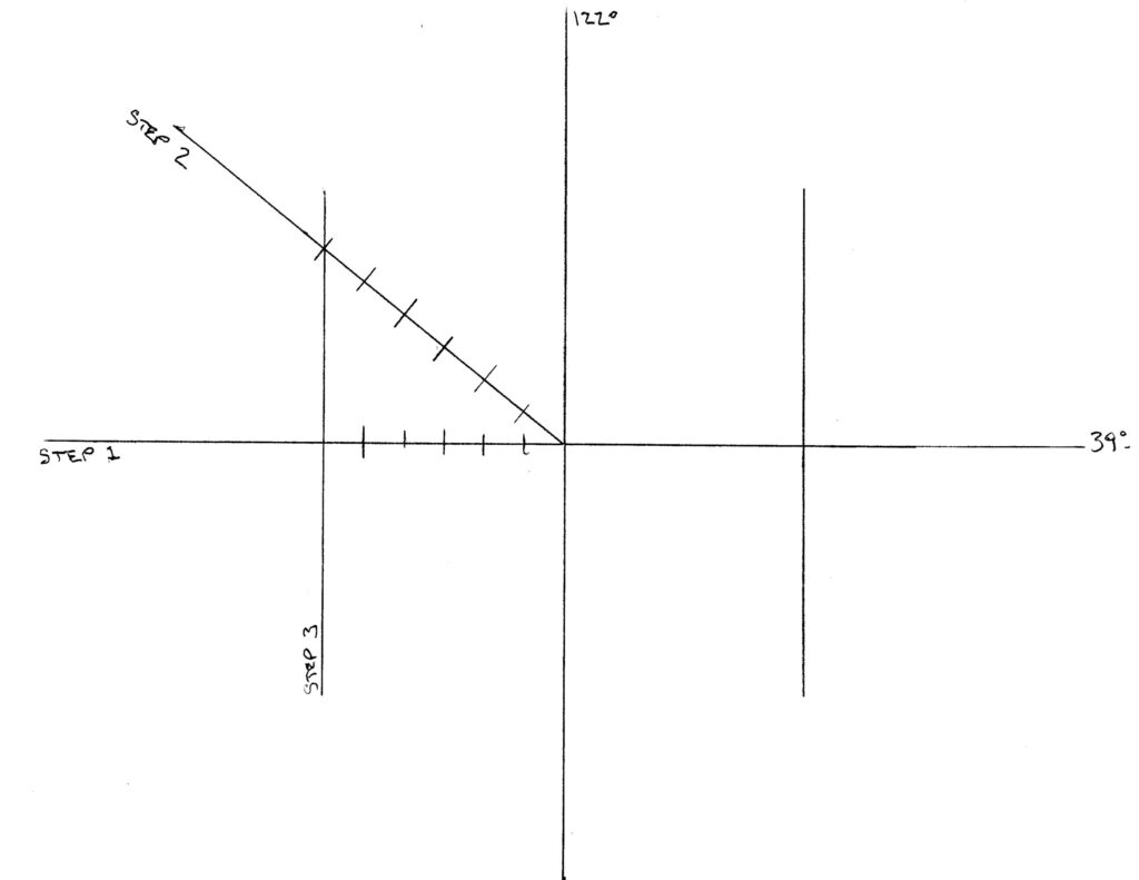
Step three: Drop a vertical line from the sixth diagonal division mark to the center latitude line. This line marks the location of the next degree of longitude. Draw another vertical line an equal distance away from the center longitude line on the opposite side. Your universal plotting sheet now includes 2 degrees of longitude. A final part of this step is to drop a mark straight down from each diagonal division down to the center latitude line. Each mark on the latitude line is equal to 10 minutes of longitude and each mark on the oblique line is equal to 10 minutes (miles) of latitude.
Find The Latitude Lines Above and Below the Primary Latitude Line
Step Four: Using dividers, measure the length of the oblique line from the center to its intersection with the longitude line. Swinging the dividers so it scribes an arc across the longitude line above and below the center latitude line provides the limits of one degree of latitude above and below the primary latitude line.
Set Up The “Minute” Marks
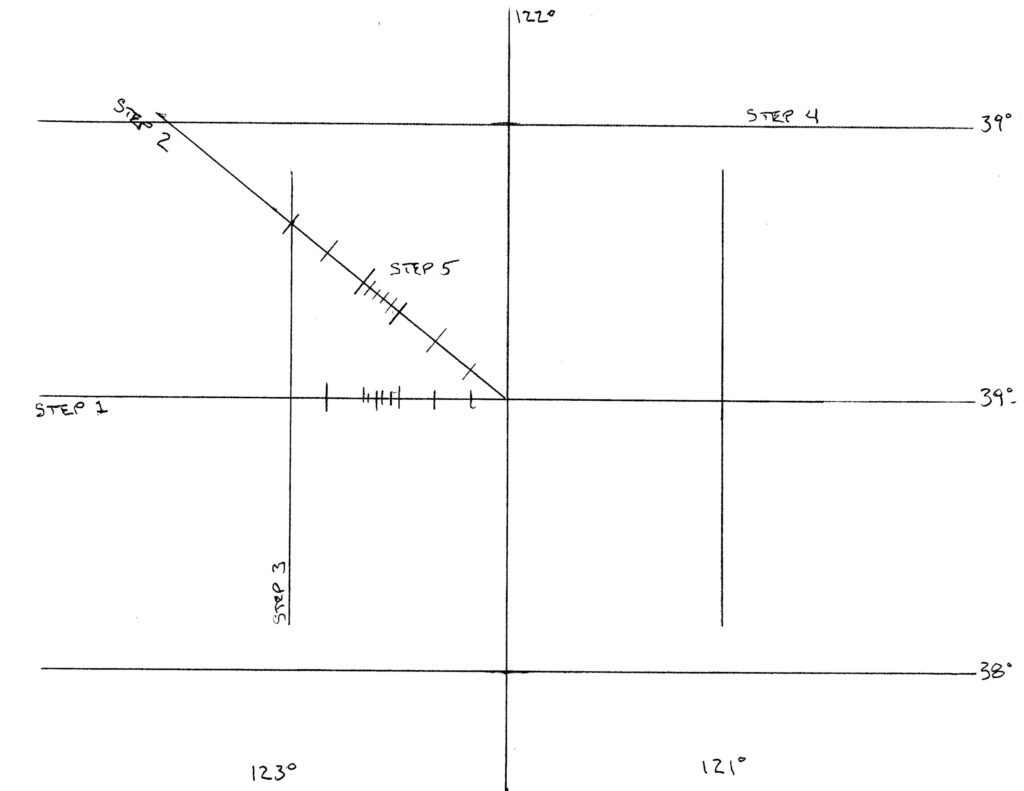
Step five: Finally, graduate the oblique line into convenient units. In the example, each marking is 2 minutes (miles). And, graduate a section of the latitude line into similar units.
Your Universal Plotting Sheet Is Ready To Use
Good news! You are ready to go. As drawn your plotting sheet covers an area of about 180 mile (E/W) by 130 miles (N/S).
A small amount of practice is all you need to get proficient.
A Final Note
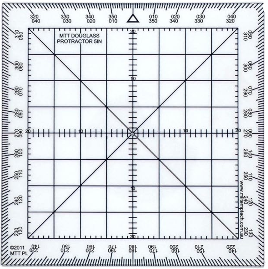
When using a universal plotting sheet, “standard” plotting tools may be a bit unwieldy. My personal preference is to use a 5 inch Douglass Protractor. It seems to be the perfect size to use with an 8.5 x 11 sheet of paper, and is conveniently marked off in 1/2 inch increments. As a bonus, each 1/2 inch is further broken down into 5 divisions, which can be used to represent 2 miles on the latitude scale. With those divisions marked on the plotting sheet is is very easy to interpolate into smaller distances.