You just finished a wonderful dinner and are back on the boat. It’s Thursday evening, and decision time. Do you return home or head up to Drakes Bay for a day or two. Time isn’t an issue. You don’t have to be back until Sunday, or even later if you want.
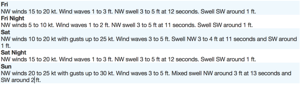
Weather forecast for the next three days.
What is your decision?
- Motor Back Home
- Motor Directly to Drakes Bay
- Sail to Drakes Bay Via the Farallon Islands?
So, you chose Sail to Drakes Bay via the Farallon Islands
Personally, I think you made the best choice.
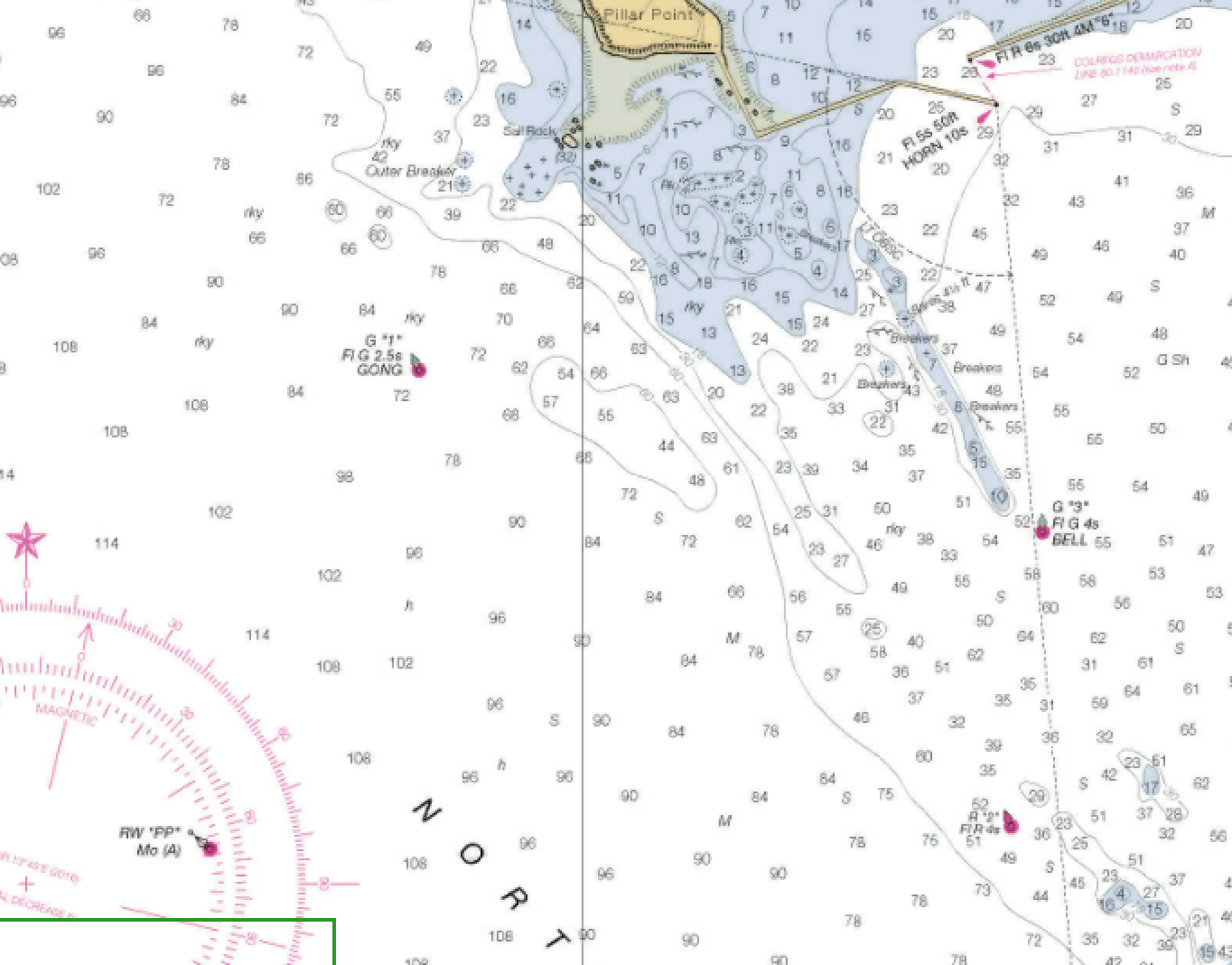
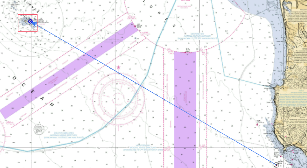
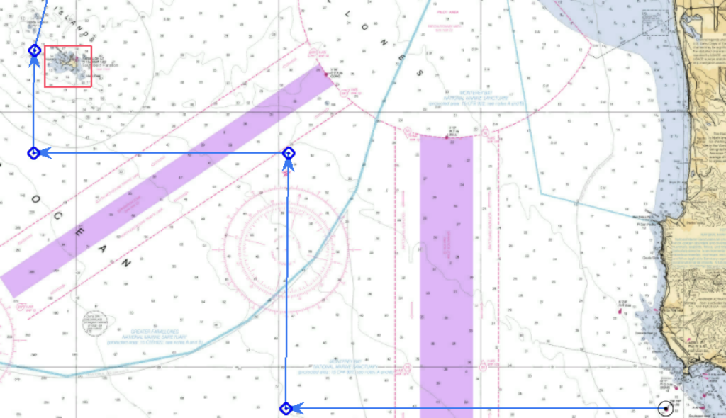
Leaving Pillar Point Harbor, you head to PP, the Pillar Point Approach Buoy where you raise your sails. Wind is from the NW (315 T). Assume your boat is able to sail to 45 degrees off the true wind, and that your speed will be 5 kts.
- What is the heading of a direct line from “PP” to the Farallon Light?
- What is your initial heading under sail?
- What heading will you tack to?
- Let’s assume you stay on your initial heading for 3 hours (at 5 kts) before tacking. What is your DR lat and long when you make your first tack.
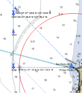
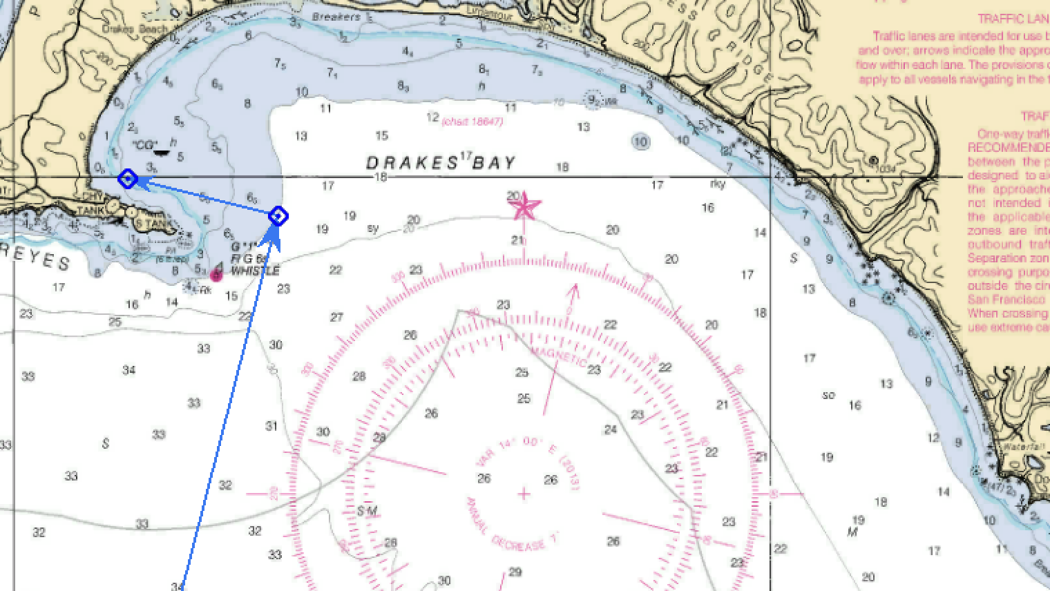
- Sunrise is 0547 on June 5 . Sunset is 2029. Assume it takes 45 minutes from your slip to “PP.” If you are able to maintain 5 kts all day, what is the latest time you would need to leave your slip in order to reach your anchorage at 38°00.0′ N; 122°58.5′ W in Drakes Bay before sunset? Plan to go around the west side of Southeast Farallon Island then between Southeast Farallon and Middle Farallon towards Drakes Bay.
Answers: No peaking until after you have done the work.
- What is the heading of a direct line from PP to the Farallon Light? 300 T
- What is your initial heading? 270 T
- What heading will you tack to? 360 T
- Let’s assume you stay on your initial heading for 3 hours (at 5 kts) before tacking. What is your DR lat and long (to the nearest 0.1′) when you make your first tack. 37°28.4′ N; 122°49.7′ W
- Sunrise is 0547 on June 5 . Sunset is 2029. Assume it takes 45 minutes from your slip to PP. If you are able to maintain 5 kts all day, what is the latest time you would need to leave your slip in order to reach your anchorage at 38°00.0′ N; 122°58.5′ W in Drakes Bay before sunset? Plan to go around the west side of Southeast Farallon Island then between Southeast Farallon and Middle Farallon towards Drakes Bay. 0803
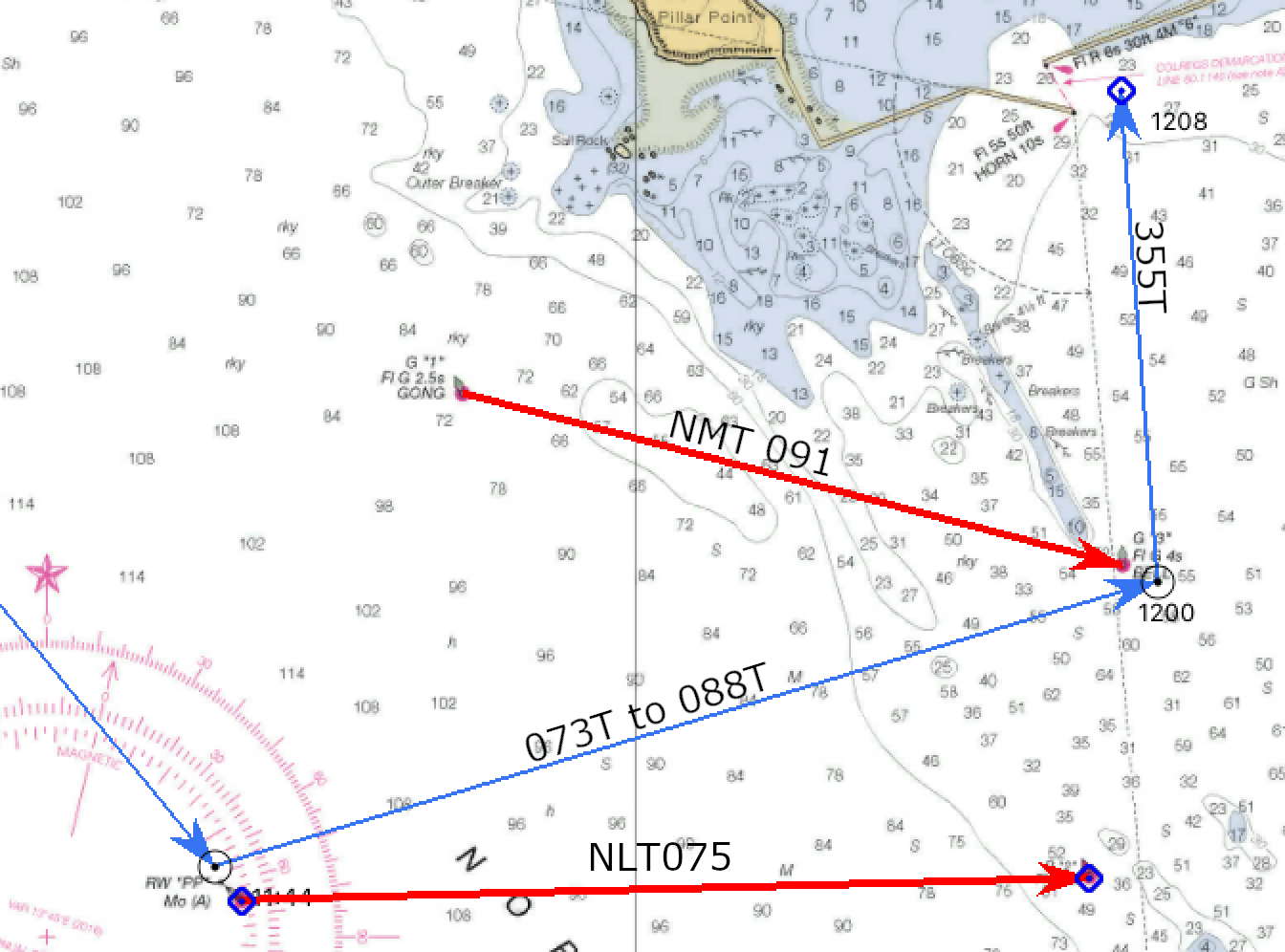
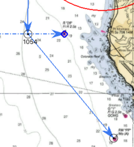
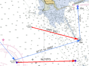
- Assuming you leave your slip at 0615 and it takes 45 minutes to reach PP, what is your ETA at the southern traffic lane?
- How long will it take to cross the lanes?
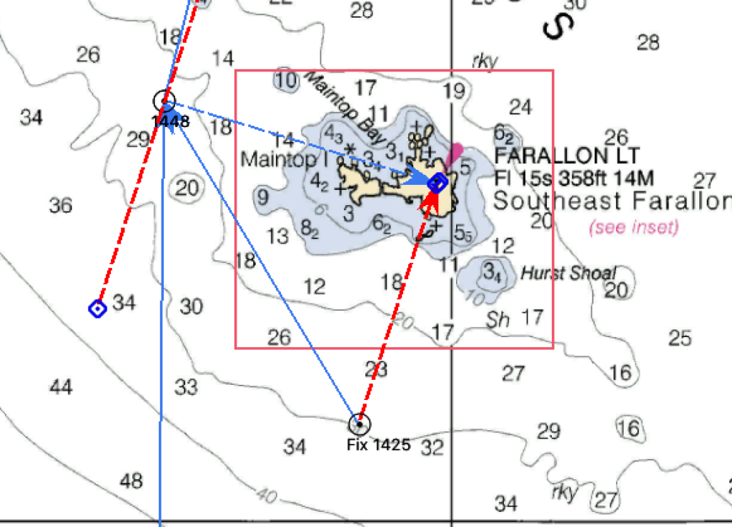
- At 1425, you take a bearing of Farallon Lt. bears 004 M, and your depth sounder reads 180 feet. What is your Lat and Long?
- What course should you steer to put you back on course to round the “back” side of Southeast Farallon?
- At 1451, you get a bearing of 093M to Farallon Lt. Use the 1425 bearing and the 1451 bearing to get a running fix. What is the Lat and Lon?

Answers: No peaking until after you have done the work.
- Assuming you leave your slip at 0615 and it takes 45 minutes to reach PP, what is your ETA at the southern traffic lane?
0819 - How long will it take to cross the lanes?
49 minutes - At 1425, you take a bearing of Farallon Lt. bears 004 M, and your depth sounder reads 180 feet. What is your Lat and Long?
37°40.6′ N; 123°00.7′ W - What course should you steer to put you back on course to round the “back” side of Southeast Farallon?
325T to 335T - At 1451, you get a bearing of 093M to Farallon Lt. Use the 1425 bearing and the 1451 bearing to get a running fix. What is the Lat and Lon?
37°42.4′ N; 123°02.1′ W